
Wellington
At
12°C
- Sunrise:
- Sunset:
Mainly fine, with cloudier periods from afternoon. Northerlies.
Rain developing in the morning, possibly heavy in the afternoon, easing to a few showers in the evening. Northerlies.
A few showers, becoming widespread in the afternoon. Northerlies, becoming strong in the afternoon.
For more detailed weather information visit MetService.
Marine Recreational Forecasts - Wellington
Area Description:
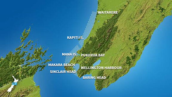
Wellington, Mana
Situation:
The ridge of high pressure weakens over the country today, while a moist northeasterly flow develops over northern New?Zealand ahead of an approaching front. Tomorrow, the front moves southeast across the country, bringing heavy rain and strong northeasterly winds to northern and central New?Zealand. The front moves east of the country on Friday morning. Over the weekend, a low in the Tasman Sea moves slowly across the North Island, while a weak ridge builds over southern New?Zealand.
Warnings:
Strong wind advisory Strong wind advisory
Forecasts:
For Wellington: Today: Northerly 15 knots, easing to 10 knots this afternoon. Sea slight. Cloud increasing this afternoon. For the South Coast and Palliser Bay: Southerly swell 1 metre. For Castlepoint: Southerly swell 1.5 to 2 metres. For Mana: Today: Northeast 10 knots, rising to northerly 15 knots for a time this afternoon and evening. Sea slight. Cloud increasing this afternoon.
Outlook:
For Wellington: Thursday: Northerly 10 knots, easing to variable 5 knots for a time in the morning, then rising to northeast 20 knots gusting 30 knots but 25 knots gusting 35 knots about the south coast for a time late afternoon and evening. Sea becoming rough about the south coast for a time late afternoon and evening. Poor visibility in periods of rain, heavy at times. For the South Coast and Palliser Bay: Southerly swell 1 metre. For Castlepoint: Southerly swell 1.5 to 2 metres. Northeast swell 1 metre developing. Friday: Northeast 10 knots, rising to northerly 15 knots in the morning. Occasional rain. For the South Coast and Palliser Bay: Southerly swell 1 metre dying out. For Castlepoint: Easterly swell 1 to 1.5 metres. Saturday: Northerly 15 knots, changing southerly 20 knots early. Rain, easing. For the South Coast and Palliser Bay: Southerly swell 2 metres developing. For Castlepoint: Easterly swell 2 metres dying out. Southerly swell 2 metres developing. Sunday: Southerly 20 knots. Cloudy. For the South Coast and Palliser Bay: Southerly swell 2 metres easing. For Castlepoint: Southerly swell 2 metres. For Mana: Thursday: Northeast 10 knots, rising to 20 knots late morning, then to 25 knots gusting 35 knots in the afternoon, before easing to 15 knots in the evening. Sea becoming rough for a time in the afternoon and evening. Poor visibility in periods of rain, heavy at times. Northwest swell 1 metre developing. Friday: Northerly 15 knots, rising to 20 knots in the morning. Occasional rain. Northwest swell 1 metre. Saturday: Northerly 20 knots, becoming southerly 20 knots early. Rain, clearing. Northwest swell rising to 2 metres for a time. Sunday: Southerly 20 knots. Partly cloudy. Westerly swell 1 metre dying out.
Swell:
Marine Coastal Forecasts - Cook
Forecast:
Wednesday: Northerly 20 knots. Sea moderate. Long period southerly swell 1 metre.
Outlook:
Outlook following 3 days: Thursday: Northeast 20 knots, rising to 30 knots north of Cape Terawhiti for a time late afternoon and early evening, then easing to northerly 15 knots everywhere late evening. Sea becoming rough in the north for a time. Long period southerly swell 1 metre. Poor visibility in periods of rain, heavy at times. Friday: Variable 10 knots, becoming northerly 20 knots early, easing to 10 knots late. Saturday: Northerly 10 knots, changing southerly 25 knots early, rising to 35 knots later. Sea becoming very rough. Southerly swell becoming moderate. Sunday: Southerly 30 knots, easing to 20 knots late. Rough sea easing. Moderate southerly swell easing.
Marine Coastal Forecasts - Castlepoint
Forecast:
Wednesday: Northerly 20 knots. Sea moderate. Long period southwest swell 2 metres offshore. Northeast swell 1 metre.
Outlook:
Outlook following 3 days: Thursday: Northerly 15 knots, rising to northeast 25 knots in the morning, then to 40 knots early evening, then easing to northerly 20 knots inshore late evening. Sea becoming very rough for a time. Northerly swell rising to 3 metres. Long period Southwest swell 2 metres offshore. Poor visibility in periods of rain, heavy at times. Friday: Northerly 20 knots, but 40 knots offshore easing to northerly 20 knots everywhere early morning, then to 10 knots late. Very rough sea offshore easing. Moderate northeast swell. Saturday: Northwest 10 knots, changing southerly 20 knots early. Moderate southeast swell. Sunday: Southerly 25 knots, easing to 15 knots late. Rough sea easing. Moderate southerly swell.